|
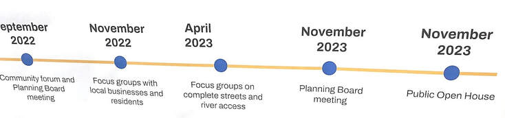
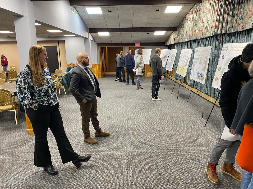
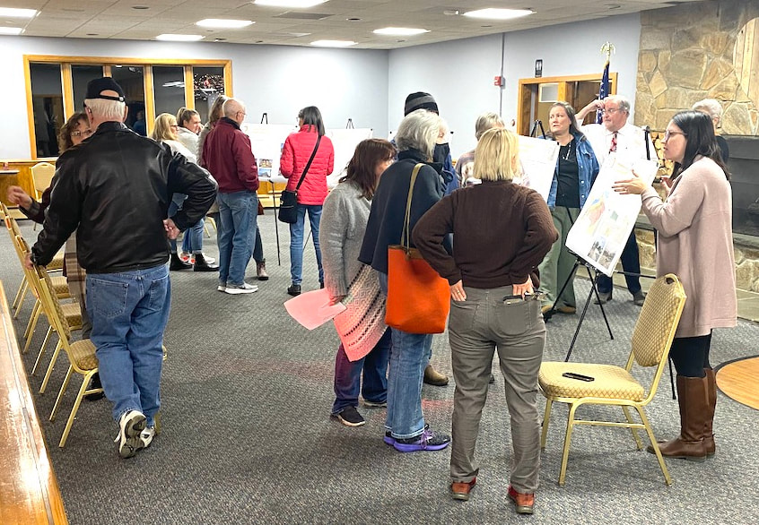
by Glenn C. Koenig, webmaster at Town Wide Mall Maynard, MA - Last night, there was a "Public Open House" for something called the "Powder Mill Road Corridor Initiative." The event was held at the Elks Lodge on Powder Mill Road, in Maynard, from 6 to 8 PM, on Wednesday, November 15th. Officials and staff members were there from the planning departments of the towns of Acton and Maynard, as well as from the Metropolitan Area Planning Council (MAPC).
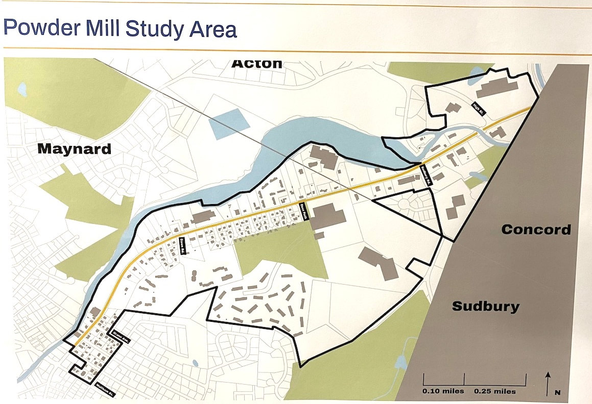
The Powder Mill Road Corridor is the name of a section of land which includes parts of Maynard and Acton. It's called a "corridor" because it is a narrow piece of land along Powder Mill Road, a major route for travel between Maynard and Acton. At the border between Acton and West Concord, the road continues as Main Street, which heads out to intersect with Route 2, the closest major state highway to Maynard. As a result, it is heavily traveled, especially during rush hours.
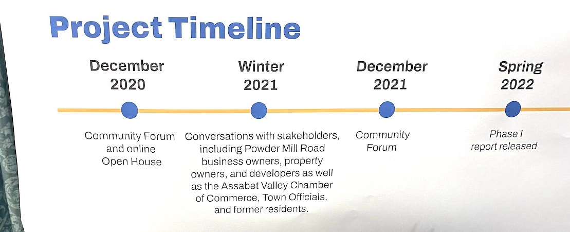
At the bottom left of the map is the intersection where Powder Mill Road meets Parker Street and crosses Waltham Street, near the BP Service Station, although the intersection itself is just outside the border of the study area. The dark black line is meant to show the edges of the study area. The blue areas show the river and the green areas are woods, wetlands, or other open areas. The term "Initiative," in this case, means that multiple government groups and citizens are working together to lay a legal foundation for change within the area shown on the map, above. The idea is to better understand certain problems (hence, a "study") and prepare to guide and support improvements (the "initiative") primarily through changes in zoning laws. Unlike many planning efforts, the initiative does not involve any specific building or road or other project as of yet. Rather the goal is to support and facilitate such changes over the next few years. The next major step in the process will be for both towns to consider and vote on zoning law changes at their respective town meetings next Spring, in 2024. For those who plan to attend town meetings at that time, learning more about this project now may be good preparation. For those not familiar with the MAPC, there is a description of the Council here: https://www.mapc.org/aboutus/ More information about the initiative is available on the MAPC web site here: https://www.mapc.org/resource-library/powder-mill-road-corridor-initiative/ Personnel at the planning departments in both Maynard and Acton told me that they do not have individual web pages devoted to the initiative currently, so the MAPC web site is the main source of information for now. A complete set of the display boards that were available at the meeting are due to be posted on the MAPC web site, starting on Monday November 27th, as the staff has to make some minor revisions.
 Note: There is more to this news story below my commentary. Comment The many facets of this project may leave some citizens feeling overwhelmed by all there is to learn. In addition, there's nothing tangible being proposed here ... yet. Until the initiative is complete and the zoning laws are changed, no specific building projects, roads, or landscaping are likely to be implemented and no money is scheduled to be raised by taxes or borrowing, etc.* Yet, I consider it highly important to stay aware of and up to date on projects like this! This is the time to understand what's entailed and where it is headed; to think through what you would like to see in this area and add your thoughts, opinions, and concerns to the mix. The more that time passes, the more other decisions are going to be made that settle certain aspects of the plans, after which buildings may be built, roads and landscaping may be changed, and wildlife areas are likely to be protected, so it may be too late to make much of a difference by then. On the other hand, some people may not have the time, or the "bandwidth," that it takes to follow and understand all of what's going on. I'm posting this news story here, now, in order to help summarize this, and inform you as best I can, but I have to work within limits. After all, sometimes "the devil is in the details" but if I tried to reproduce all the details of the study or the initiative here in this news article, I'd have time for little else, and many people would tire of reading about it all, well before reaching the end. There is unlikely to be any single vote at the ballot box to approve or disapprove of what will take place. This is the "background" part of democracy that goes beyond voting on election day or debating over candidates. This work is being done by the people within government who are hired (either directly or indirectly) by the elected officials for whom we vote at election time.
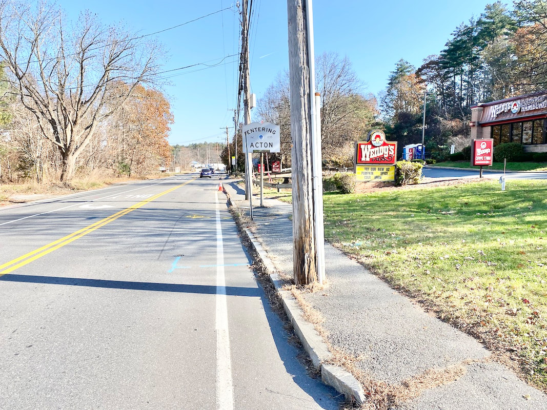
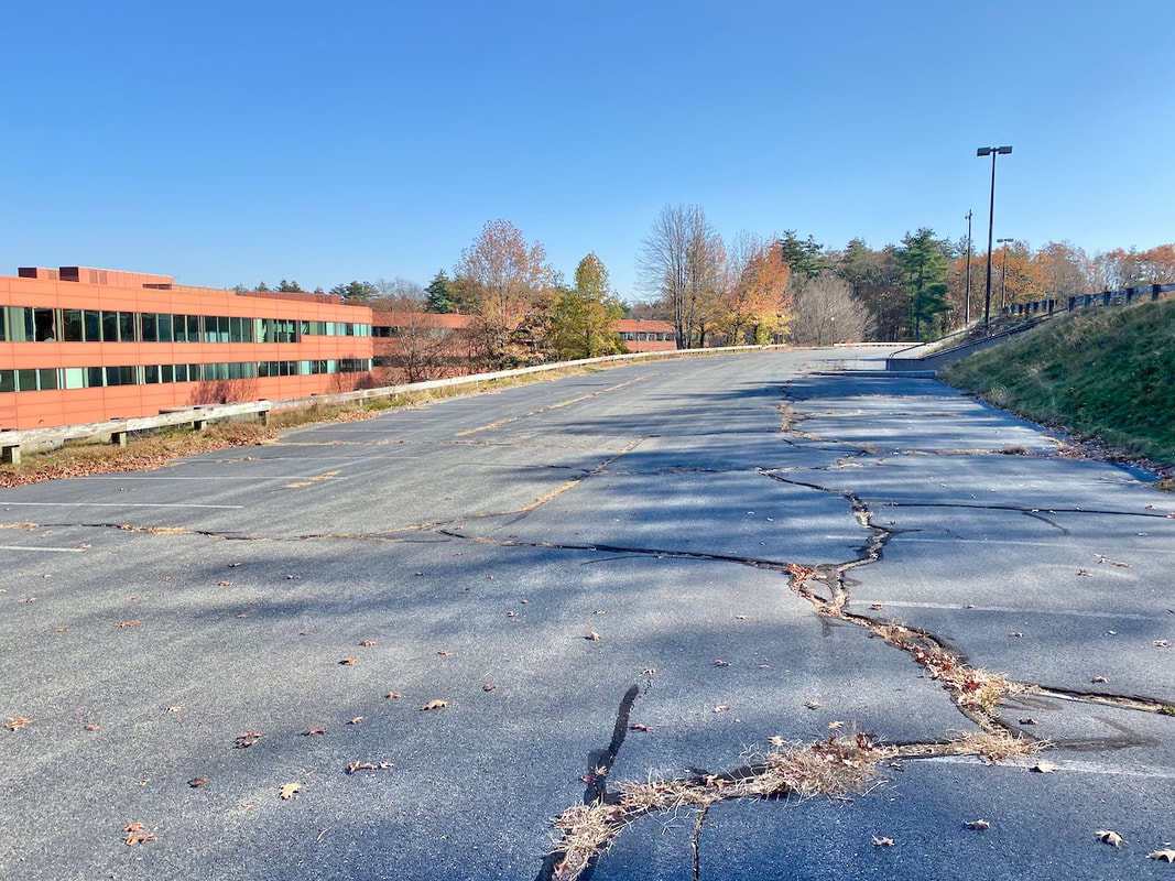
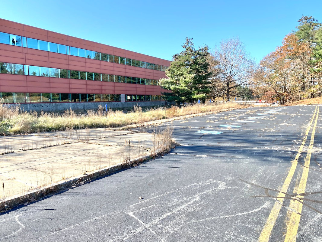
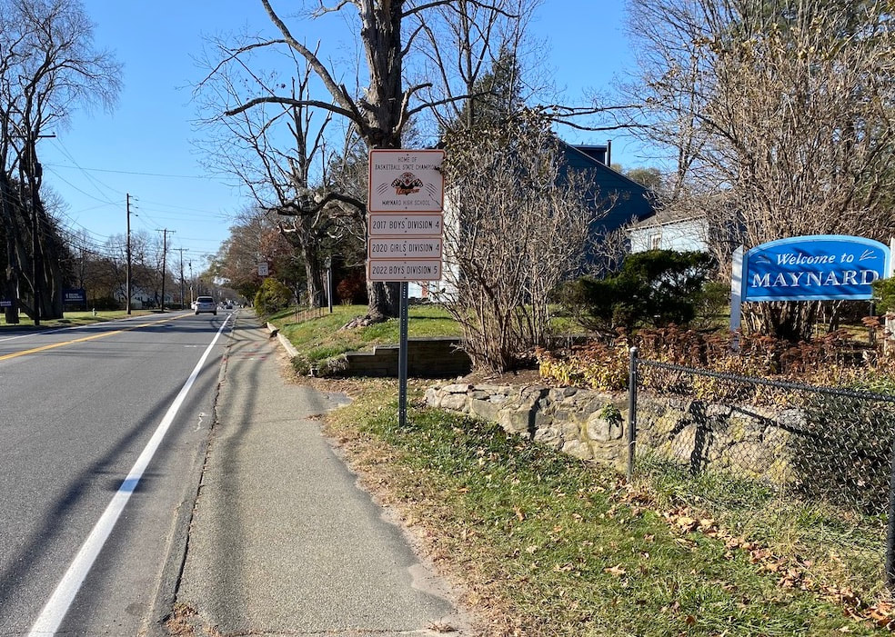
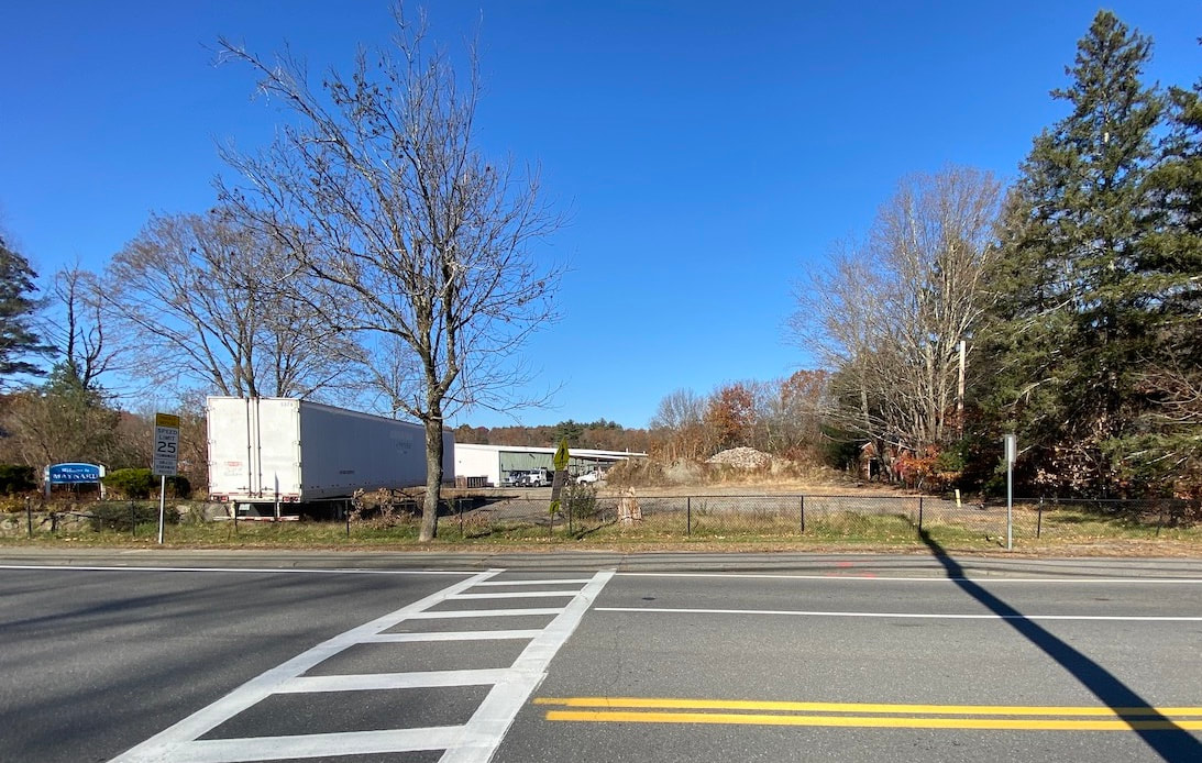
However, as important public opinion is, it helps if individuals who wish to provide input take the time, before hand, to catch up with what's been done so far. Many questions and concerns have already been reviewed over the past three years. This public open house was one attempt to update people on what's been done, where we are now, and receive input. At this point the MAPC web site is the main resource for further details. I urge anyone preparing to contact the respective planning departments or MAPC staff to start out with getting their questions answered, first, if possible, before continuing with suggestions or critique. * Note: It's possible for construction or changes to be made on private property now, but only in conformance with the existing zoning laws now in place. Developers of major projects are likely to wait until new plans are in place before proceeding, in order to avail themselves of new options that may be of advantage to both themselves and the public. Picturing the Area Continued from the News section, above. Anyone driving along Powder Mill Road is likely to be familiar with some aspects of the area but not familiar with others that are less obvious. I went out and took a few photographs to help get a better idea.
There seems to be an increased demand for bicycle use along this way. However, implementing a "share the road" option (where bicyclists travel in the same lane as cars and trucks) may be unsafe for all but the most accomplished bicyclists because of the speed and volume of traffic. How might we accommodate bicycle use here? Do we widen the road? Are there other options?
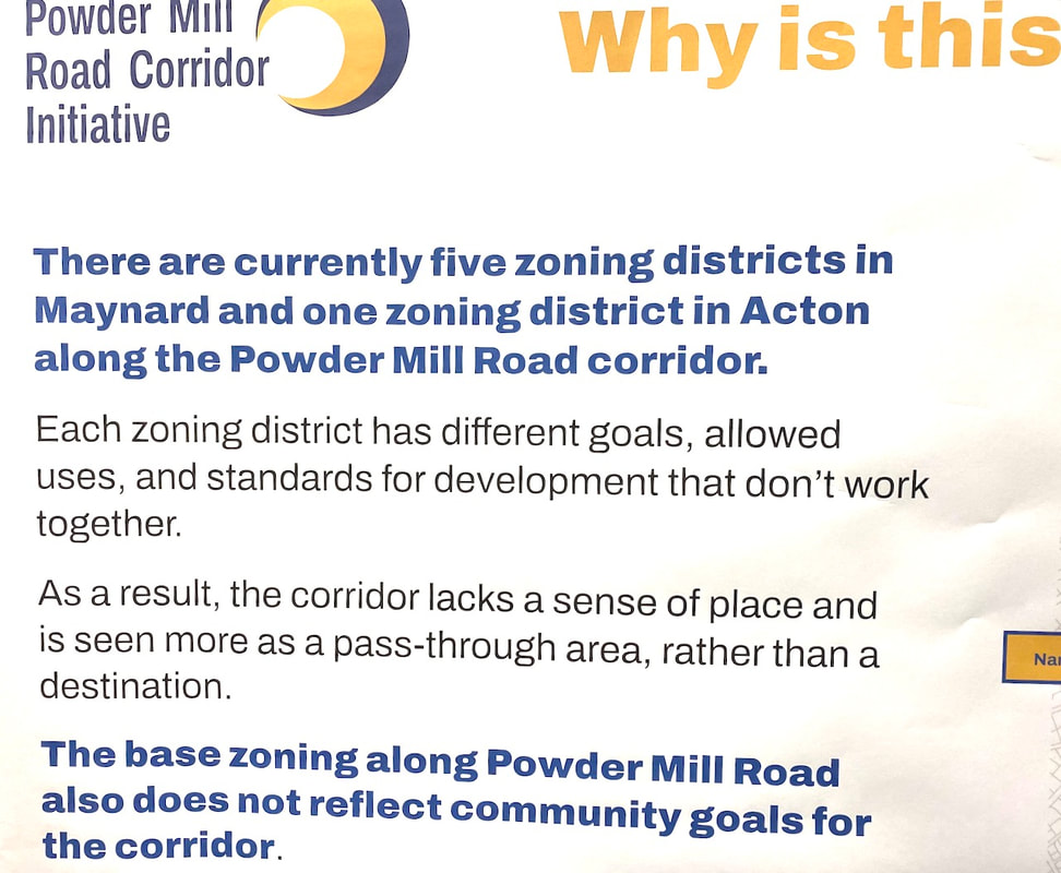
There are other features within the project area that I did not have time to photograph, research, or describe here. Some areas were photographed by staff working on the project and were included on the display boards exhibited at the meeting. When those are posted online, later this month, they will become available for viewing by the public on the web (see the MAPC project link above). Some Definitions and Comment Zoning Laws: Zoning Laws are a separate body of town laws, based partly on state and federal laws and regulations. They evolved to help communities organize areas for development within town boundaries, and specify what kinds of buildings can be built, and what general kinds of activities can occur within each zone. For example, most people wouldn't want to live in a house with a gasoline service station on one side, a scrap yard on the other side and a forge (where hot metal parts are pounded into shape) across the street. Zoning attempts to classify areas as "residential," "commercial," "industrial," "farming," or perhaps wildlife preserves, in order to group similar uses in compatible areas. When done well, zoning helps both developers and community members know what to expect before moving in or building on available land. When done poorly, they can end up discriminating against certain groups (racial or economic, sometimes known as "snob zoning,"), cause undue hardship on developers wishing to comply with regulations, and leave loopholes where development that's overbearing or out of character with the neighborhood can go ahead. Once that happens, there is seldom any "Undo Button" to return the land to its former state. Overlay Zone (or Overlay District): It's possible to create a zone that overlaps or covers areas already covered by separate zoning laws. This can help provide consistency throughout an entire area, specifying some conditions that would be too time consuming to be included in each separate zone thus covered. This term is used on some of the display boards and in some documents describing the protect. I located a good concise definition of this here: https://www.planetizen.com/definition/overlay-districts Again, the object of all this is to have a consistent plan that both the public and developers can rely upon to proceed in a compatible manner. The challenge is to make these laws clear and reasonable and straightforward to enforce. If they fall short of those goals, developers can experience too many confusing or conflicting regulations (aka "government red tape") which delays projects unnecessarily, can result in court hearings, and drives up costs. Meanwhile the public may be left in confusion or in conflict over the nature and intent of the policy and its impact on the community overall. When that happens, government itself ends up wasting time and money trying to resolve all the issues. I’d like to thank everyone who has donated to Town Wide Mall so far. If you have not donated before, please consider making a donation now. Town Wide Mall is free for anyone to read and carries no advertising, so our only means of support is donations from readers.
For details, please click on the "Donate" button below. Once you do, you can still decide to donate at a later time, if you wish. And thank you!
2 Comments
Alex Duncan
11/20/2023 09:17:10 am
Love the proposal. As Maynard resident, who travels via bicycle on Powder Mill, it would be amazing to see a dedicated bike lane. It would be even better to see pedestrian friendly and bike-friendly businesses along this corridor, and expand the recreational opportunities (e.g., use of Assabet). This would greatly improve the attractiveness and liveability of the area.
Beau Schless
12/8/2023 08:33:30 am
Would love to see a bike friendly path on all of Powder Mill including upper Powder Mill and down the hill. ar least now the pavement is fresh Leave a Reply. |
AuthorWrite something about yourself. No need to be fancy, just an overview. Archives
June 2024
Categories |
 RSS Feed