|
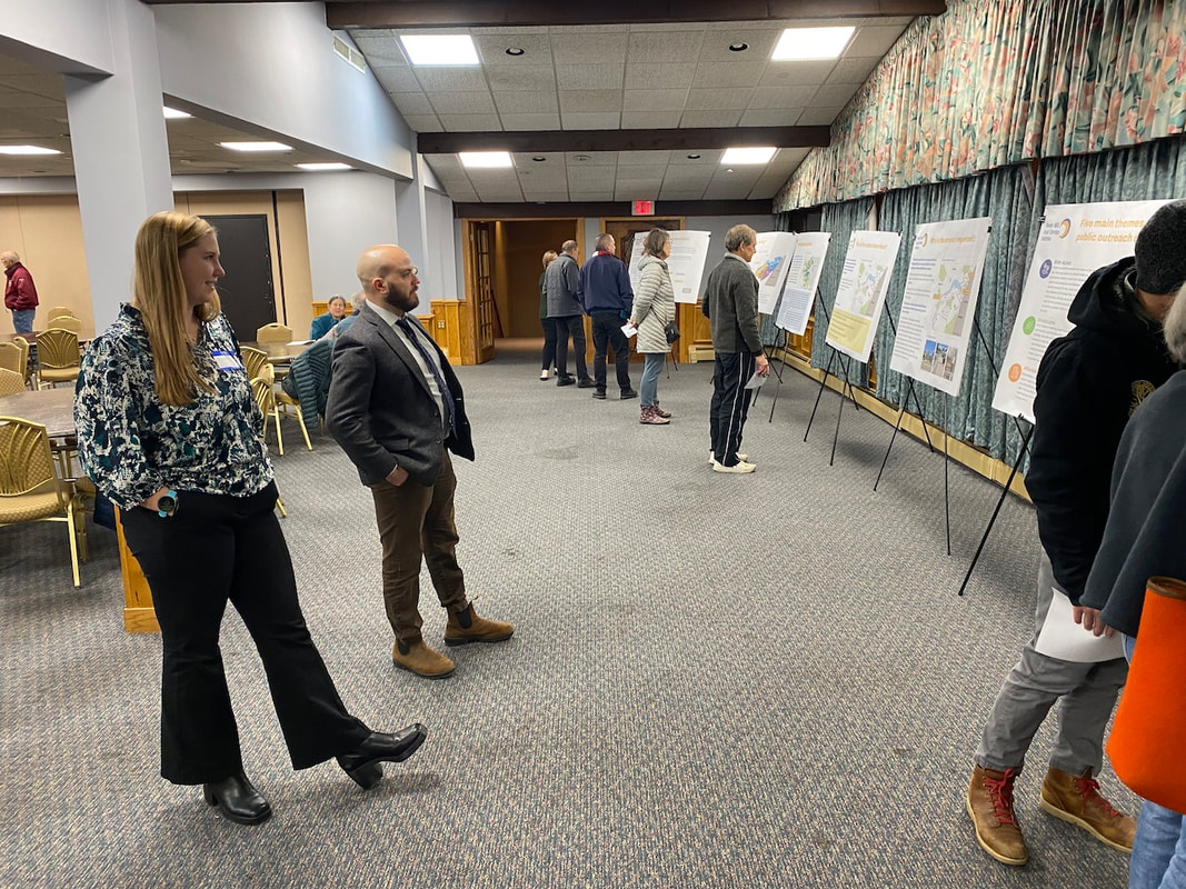
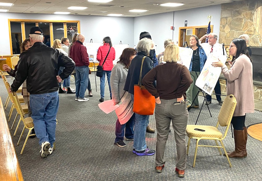
by Glenn C. Koenig, webmaster at Town Wide Mall Maynard, MA - Last night, there was a "Public Open House" for something called the "Powder Mill Road Corridor Initiative." The event was held at the Elks Lodge on Powder Mill Road, in Maynard, from 6 to 8 PM, on Wednesday, November 15th. Officials and staff members were there from the planning departments of the towns of Acton and Maynard, as well as from the Metropolitan Area Planning Council (MAPC).
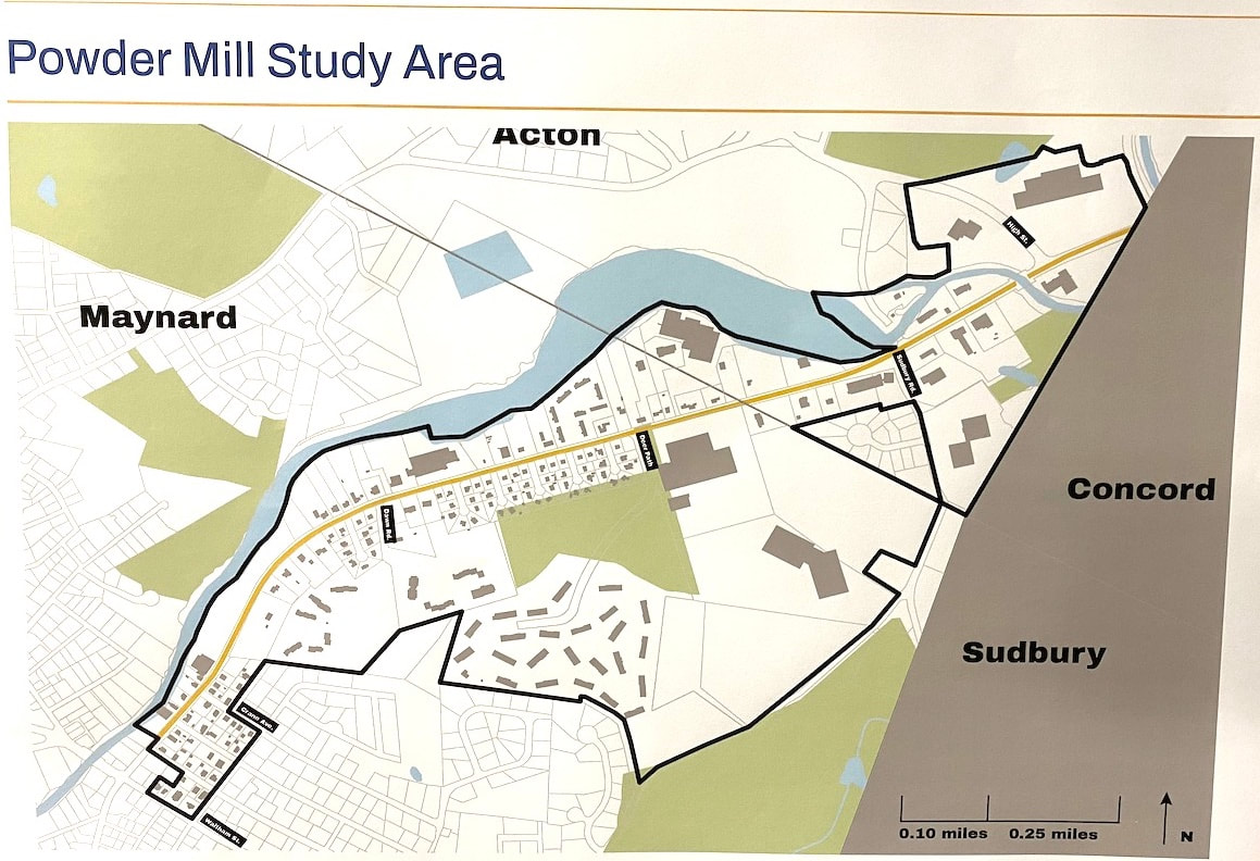
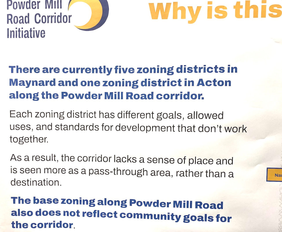
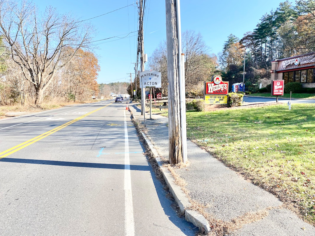
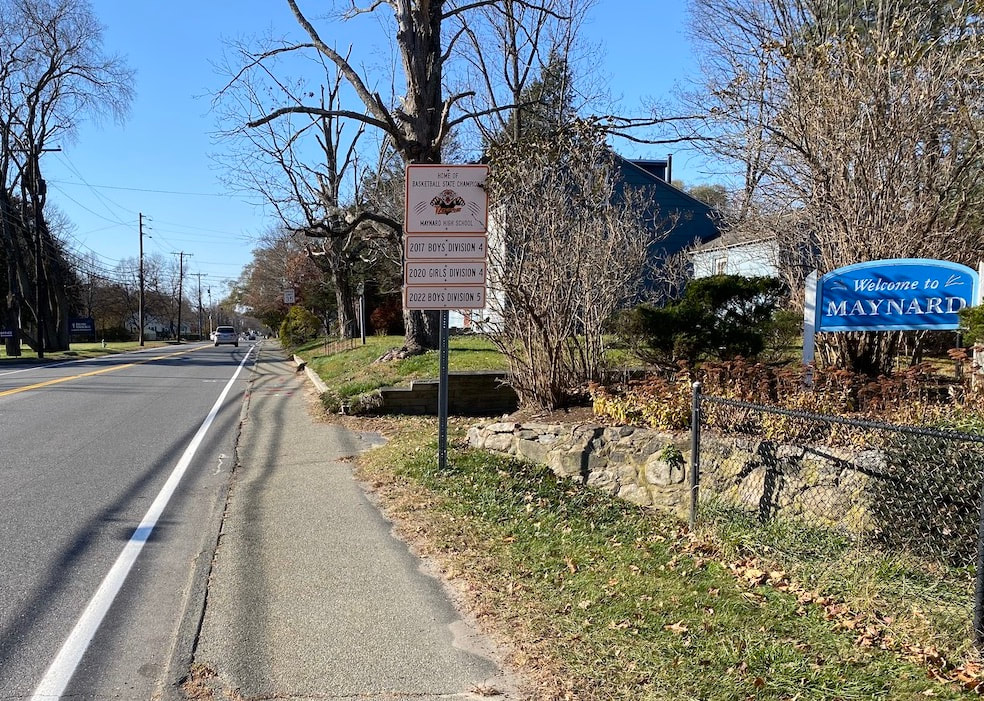
The Powder Mill Road Corridor is the name of a section of land which includes parts of Maynard and Acton. It's called a "corridor" because it is a narrow piece of land along Powder Mill Road, a major route for travel between Maynard and Acton. At the border between Acton and West Concord, the road continues as Main Street, which heads out to intersect with Route 2, the closest major state highway to Maynard. As a result, it is heavily traveled, especially during rush hours.
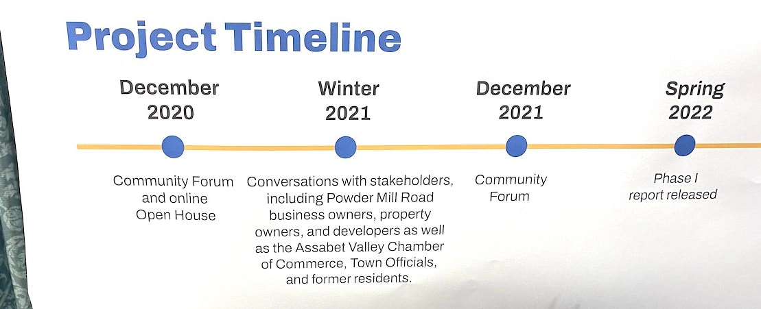
At the bottom left of the map is the intersection where Powder Mill Road meets Parker Street and crosses Waltham Street, near the BP Service Station, although the intersection itself is just outside the border of the study area. The dark black line is meant to show the edges of the study area. The blue areas show the river and the green areas are woods, wetlands, or other open areas. The term "Initiative," in this case, means that multiple government groups and citizens are working together to lay a legal foundation for change within the area shown on the map, above. The idea is to better understand certain problems (hence, a "study") and prepare to guide and support improvements (the "initiative") primarily through changes in zoning laws. Unlike many planning efforts, the initiative does not involve any specific building or road or other project as of yet. Rather the goal is to support and facilitate such changes over the next few years. The next major step in the process will be for both towns to consider and vote on zoning law changes at their respective town meetings next Spring, in 2024. For those who plan to attend town meetings at that time, learning more about this project now may be good preparation. For those not familiar with the MAPC, there is a description of the Council here: https://www.mapc.org/aboutus/ More information about the initiative is available on the MAPC web site here: https://www.mapc.org/resource-library/powder-mill-road-corridor-initiative/ Personnel at the planning departments in both Maynard and Acton told me that they do not have individual web pages devoted to the initiative currently, so the MAPC web site is the main source of information for now. A complete set of the display boards that were available at the meeting are due to be posted on the MAPC web site, starting on Monday November 27th, as the staff has to make some minor revisions.
 Note: There is more to this news story below my commentary. Comment The many facets of this project may leave some citizens feeling overwhelmed by all there is to learn. In addition, there's nothing tangible being proposed here ... yet. Until the initiative is complete and the zoning laws are changed, no specific building projects, roads, or landscaping are likely to be implemented and no money is scheduled to be raised by taxes or borrowing, etc.* Yet, I consider it highly important to stay aware of and up to date on projects like this! This is the time to understand what's entailed and where it is headed; to think through what you would like to see in this area and add your thoughts, opinions, and concerns to the mix. The more that time passes, the more other decisions are going to be made that settle certain aspects of the plans, after which buildings may be built, roads and landscaping may be changed, and wildlife areas are likely to be protected, so it may be too late to make much of a difference by then. On the other hand, some people may not have the time, or the "bandwidth," that it takes to follow and understand all of what's going on. I'm posting this news story here, now, in order to help summarize this, and inform you as best I can, but I have to work within limits. After all, sometimes "the devil is in the details" but if I tried to reproduce all the details of the study or the initiative here in this news article, I'd have time for little else, and many people would tire of reading about it all, well before reaching the end. There is unlikely to be any single vote at the ballot box to approve or disapprove of what will take place. This is the "background" part of democracy that goes beyond voting on election day or debating over candidates. This work is being done by the people within government who are hired (either directly or indirectly) by the elected officials for whom we vote at election time.
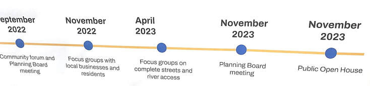
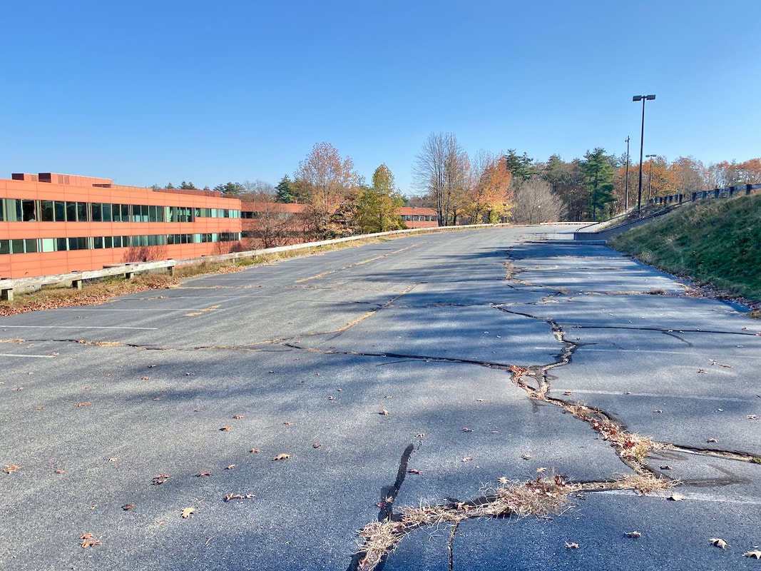
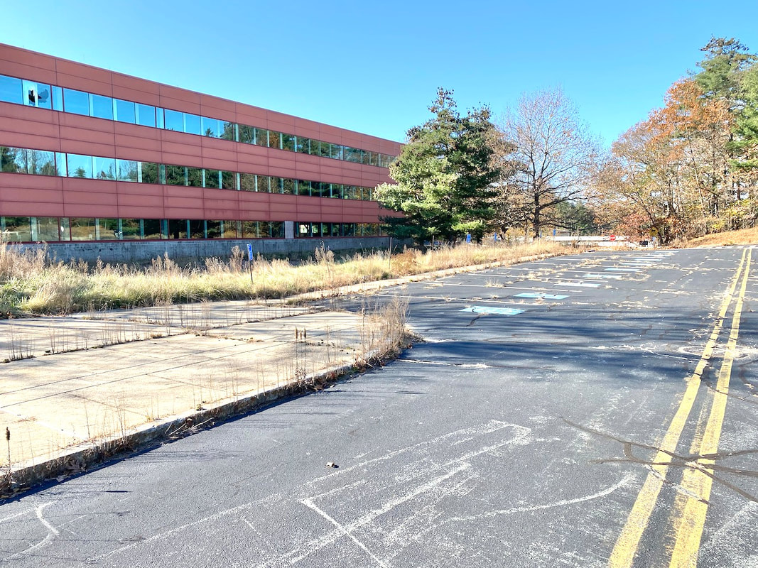
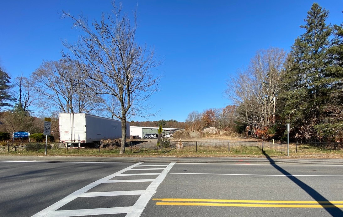
However, as important public opinion is, it helps if individuals who wish to provide input take the time, before hand, to catch up with what's been done so far. Many questions and concerns have already been reviewed over the past three years. This public open house was one attempt to update people on what's been done, where we are now, and receive input. At this point the MAPC web site is the main resource for further details. I urge anyone preparing to contact the respective planning departments or MAPC staff to start out with getting their questions answered, first, if possible, before continuing with suggestions or critique. * Note: It's possible for construction or changes to be made on private property now, but only in conformance with the existing zoning laws now in place. Developers of major projects are likely to wait until new plans are in place before proceeding, in order to avail themselves of new options that may be of advantage to both themselves and the public. Picturing the Area Continued from the News section, above. Anyone driving along Powder Mill Road is likely to be familiar with some aspects of the area but not familiar with others that are less obvious. I went out and took a few photographs to help get a better idea.
There seems to be an increased demand for bicycle use along this way. However, implementing a "share the road" option (where bicyclists travel in the same lane as cars and trucks) may be unsafe for all but the most accomplished bicyclists because of the speed and volume of traffic. How might we accommodate bicycle use here? Do we widen the road? Are there other options?
There are other features within the project area that I did not have time to photograph, research, or describe here. Some areas were photographed by staff working on the project and were included on the display boards exhibited at the meeting. When those are posted online, later this month, they will become available for viewing by the public on the web (see the MAPC project link above). Some Definitions and Comment Zoning Laws: Zoning Laws are a separate body of town laws, based partly on state and federal laws and regulations. They evolved to help communities organize areas for development within town boundaries, and specify what kinds of buildings can be built, and what general kinds of activities can occur within each zone. For example, most people wouldn't want to live in a house with a gasoline service station on one side, a scrap yard on the other side and a forge (where hot metal parts are pounded into shape) across the street. Zoning attempts to classify areas as "residential," "commercial," "industrial," "farming," or perhaps wildlife preserves, in order to group similar uses in compatible areas. When done well, zoning helps both developers and community members know what to expect before moving in or building on available land. When done poorly, they can end up discriminating against certain groups (racial or economic, sometimes known as "snob zoning,"), cause undue hardship on developers wishing to comply with regulations, and leave loopholes where development that's overbearing or out of character with the neighborhood can go ahead. Once that happens, there is seldom any "Undo Button" to return the land to its former state. Overlay Zone (or Overlay District): It's possible to create a zone that overlaps or covers areas already covered by separate zoning laws. This can help provide consistency throughout an entire area, specifying some conditions that would be too time consuming to be included in each separate zone thus covered. This term is used on some of the display boards and in some documents describing the protect. I located a good concise definition of this here: https://www.planetizen.com/definition/overlay-districts Again, the object of all this is to have a consistent plan that both the public and developers can rely upon to proceed in a compatible manner. The challenge is to make these laws clear and reasonable and straightforward to enforce. If they fall short of those goals, developers can experience too many confusing or conflicting regulations (aka "government red tape") which delays projects unnecessarily, can result in court hearings, and drives up costs. Meanwhile the public may be left in confusion or in conflict over the nature and intent of the policy and its impact on the community overall. When that happens, government itself ends up wasting time and money trying to resolve all the issues. I’d like to thank everyone who has donated to Town Wide Mall so far. If you have not donated before, please consider making a donation now. Town Wide Mall is free for anyone to read and carries no advertising, so our only means of support is donations from readers.
For details, please click on the "Donate" button below. Once you do, you can still decide to donate at a later time, if you wish. And thank you!
2 Comments
by Glenn C. Koenig, webmaster at Town Wide Mall
station), then turn and head up Summer Street, to stop at Memorial Park, across the street from the Fine Arts Theatre. There, marchers will stop to gather for a brief ceremony. After that, the parade will reform, head down Nason Street and return to Town Hall. A few details are available at the town's web site, here: https://www.townofmaynard-ma.gov/CivicAlerts.aspx?AID=127 And on the Discover Maynard web site, here: https://discovermaynard.com/event/veterans-day-parade/ There is some background on the holiday, on Wikipedia, here: https://en.wikipedia.org/wiki/Veterans_Day
Veterans Day began as "Armistice Day," when, at "the 11th hour of the 11th day of the 11th month of 1918 the Armistice with Germany went into effect, officially ending World War I, then known simply as "The World War" or "The Great War" (as no one at the time anticipated that another world war was yet to take place, merely 20 years later). In 1954, the name of the day was changed to Veterans Day to honor American veterans of all wars. Comment I once heard someone say that World War II was the last good war. My mother told me that when she asked her father, who had fought in World War I, what it was like, he replied "War is Hell!" In those days, the word hell was considered taboo, but I think he wanted to emphasize the point. The process of trying to kill others before they kill you, and watching others die is one of the most disturbing experiences anyone can have. No wonder many veterans just decline to ever talk about what it was like.
In my mind there is no such thing as a "good" war. To me, war is glaring evidence that we have failed to find a better way to resolve our differences peacefully and make amends for ways in which we may have harmed each other in the past. I should correct that and say that many people have found ways to settle differences and make amends without resorting to violence and destruction. Perhaps we're just working toward the day when those ways become so widespread and accepted that war is no longer considered an option. When war is anticipated or breaks out, there seems to be lots of support for the enterprise, but when it's over, the horror of it all apparently leaves us wishing to leave it all behind and get on with our lives. We mourn the dead every year, but, sadly, the veterans who survived often end up neglected in the process. Their names are not carved into the stone monuments or cast onto the plaques. Many of them have been injured, either physically or mentally, and need our support and care but end up feeling forgotten. It's as if they remind us of something we wish we hadn't participated in. Budgets are cut, services end up diminished, and veterans are sometimes left to fend for themselves. Many end their own lives out of despair. Just showing up at a parade won't do much to change this, perhaps. But please show up anyway. Dress warmly, as it will be chilly, but the forecast is for sunny skies and calm conditions. Oh, and by the way, I am a veteran. I am fortunate to have remained in the US mainland during the Viet Nam war, so I did not engage in combat. I'm willing to discuss my experiences with anyone, so please don't hesitate to ask me. I'll be there tomorrow. I hope to see you there. by Glenn C. Koenig, webmaster for Town Wide Mall
The vote does two things. First, it authorizes the town to borrow the money by selling bonds on the bond market (known as a "bond issue"), in order to raise the funds to build the school as soon as possible. Second, it approves the paying back of the bonds, with interest, over the next 30 years by increasing property taxes above the normal 2.5% annual tax increase limit, as imposed on cities and towns by state law. This is known as a "debt exclusion" because this tax increase is "excluded" from the normal annual tax limit, allowing taxes to be raised more than the usual amount. Only certain types of expenses., such as the incurring of debt to build buildings, can qualify for such over-limit tax increases, under state law. Each such exclusion must be approved by voters in a general election before it can take effect. Comment Although this measure is now approved, there are many steps ahead in completing the design, getting the proper permits, and working out other details before construction can actually start. I encourage everyone to keep an eye out for updates, additional information, and future meetings, in order to stay on top of the process, as much as possible. Democracy does not end at the ballot box, it is an ongoing process where citizens and goverment must work together to achieve the best outcomes.
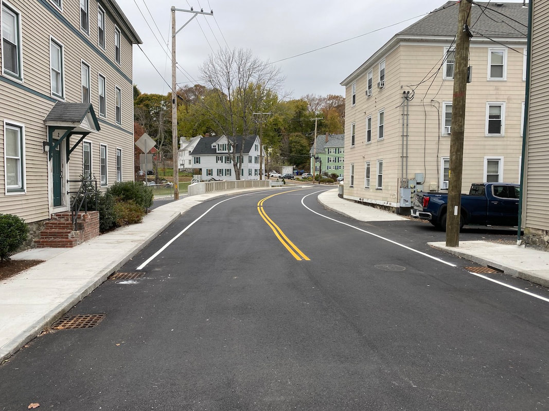
I will do my best to provide occasional updates in this news feed, here on Town Wide Mall. by Glenn C. Koenig, webmaster at Town Wide Mall Note: This is two stories in one post. The second story starts just below the first one. Florida Road Bridge Now Open!
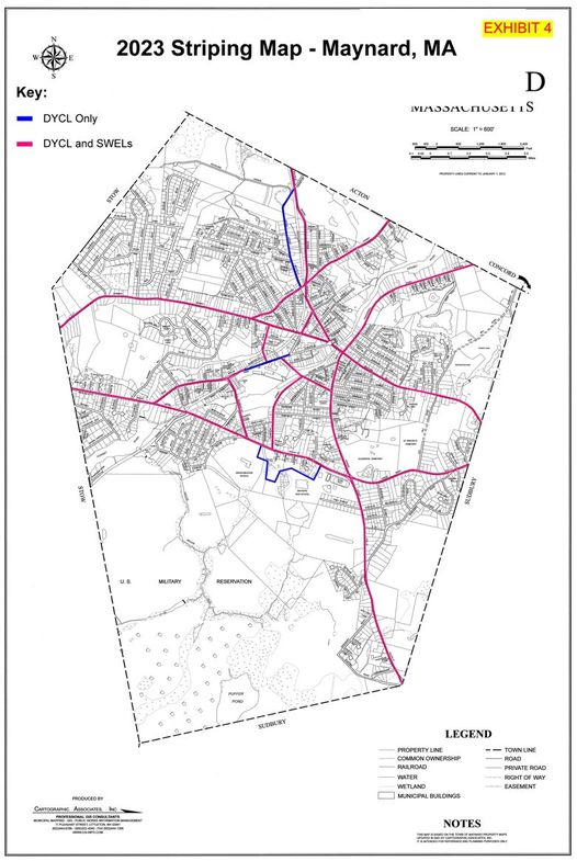
Having Mass DOT manage bridge construction is typical in Massachusetts. For details, please see my previous story, Public Workings #1. Plans are to have the ownership of the bridge transferred back to the Town of Maynard, but the official date and likely ceremony are not available at this time.  Maynard residents are now able to say "good riddance" to the many detour signs, no longer needed. Make way for Traffic Line Painting! Maynard, MA - The Maynard Department of Public Works has announced that the center and side lines on most of the major roads in town will be repainted during an overnight operation this week. The project will start this Wednesday, November 8th, at 9:00 PM and continue until the work is done the following morning, Thursday, November 9th. The DPW and the Police Department are asking all town residents to refrain from parking on the designated streets and roads, and avoid driving or walking on the lines, while they remain marked off with traffic cones, until they are fully dry.
The process, known in the construction industry as "Striping" or "Pavement Marking" will involve applying a special material to the pavement surface (not always "paint" as we know it). In some cases, the lines may consist of heated thermoplastic, which then cools and hardens. A layer of reflective material is typically applied on top (consisting of extremely small glass beads).
It's done this way so that the resulting stripes will reflect light at night for better visibility, while the paint or other material is designed expand and contract at the same ratio as the asphalt beneath. This is necessary as the road surface will undergo extreme temperature changes, from the hottest days in the summer to well below freezing in the winter. If this was not done, the lines might wear out prematurely, or even erode the asphalt beneath them. To learn more about the process, here are some relevant links. The first is an animated story presentation, showing the workers and equipment used (in this case, in another state) for highway marking: https://www.nytimes.com/interactive/2021/08/26/arts/design/road-lines.html The second one is more about the challenges of formulating the striping materials and the chemistry involved: https://pubsapp.acs.org/cen/science/88/8836sci4.html I have included this second link because I never want to underestimate the interests or capacity of readers for understanding the technology of today's world, and the nuances of the trade offs involved in creating it. This relates to my firm belief in the benefit of lifelong learning. |
AuthorWrite something about yourself. No need to be fancy, just an overview. Archives
June 2024
Categories |

 RSS Feed